|
|
Разместил: Radist73  Просмотров этой страницы: 37636 Просмотров этой страницы: 37636 |
|
|
Описание файла
|
|
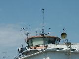
Google Earth KMZ файл, влкючает отображение всех воздушных зон, трас, аэропортов и т.п.
|
|
|
|
|
| Автор |
Комментарий |
cooluser
Участник
|
23 Авг 2009 22:32
У кого-нибудь данный файл работает? Я так понимаю там ссылки на сервер, который уже не существует
|
easyrider
Участник
 |
24 Сен 2009 10:59
What is the Digital Aeronautical Flight Information File?
The Digital Aeronautical Flight Information File (or DAFIF) is a set of files that contain data on airports, navaids, waypoints, special use airspace and other facts relevant to flying in the entire world. This data is provided by the US military, through the National Geospatial Intelligence Agency (NGA), and is primarily developed for the benefit of military aeronautical operations, but was made available to the general public.
Except for the United States, which is also covered by data provided by the FAA, it is usually the ONLY comprehensive digital data available for pilots. Other countries either don't provide digital data at all, or they do it through a proprietary web interface or in non-reusable formats (like PDF files of scans of paper documents). Even within the US, there is data that is available in the DAFIF which is not in the FAA ATA-100 data CD. For instance, the navaid.com database generators use the DAFIF data to find ICAO identifiers for airports in Alaska, Hawaii, Puerto Rico and other places where there 3 letter FAA id is not enough data to generate the ICAO id.
It also has data on airspace boundaries and airways that is missing from the FAA data.
While GPS and Electronic Flight Bag manufacturers can afford to license expensive proprietary data from Jeppesen to cover their areas of interest, for the free or nearly-free software developer, and the thousands of pilots who rely on our programs, DAFIF is the only choice.
Why is our access to DAFIF under threat gone?
According to the explanation on the NGA Web site, the data is being withdrawn from public circulation because "increased numbers of foreign source providers are claiming intellectual property rights or are forewarning NGA that they intend to copyright their source." According to one private communication I received from the DAFIF program manager, they are doing this "because the Australian AIP producers are suing Jeppesen for copyright infringement", and rather than waiting to see if the AIP producers win their case and then turn their attention to DAFIF, they are being pro-active, or looking at it another way, they are taking the easy way out.
What is going to happen to DAFIF data?
The NGA is going to restrict access to their data so that only legitimate US State and Federal government agencies and their contractors may access the data. The rest of us will be out in the cold, and will not be able to get updated data any longer.
I do not know yet if NGA intends to tell people using old versions of DAFIF data that they will have to stop using it. I consider it a distinct possibility.
What can I do to preserve access to this invaluable resource?
Nothing. It's on its last legs, and will be gone within the year. The NGA has just released their decision, and according to their press release, "the electronic distribution of DAFIF over the World Wide Web (www) and public sale of NGA FLIP outside US airspace will cease in October 2006". We're screwed.
What else?
I have set up a Wiki to discuss the design of a collaborative project to allow we, the users of the data, to maintain it in the future. Please feel free to register and give us your input.
|
vova_sam
Участник
 |
05 Окт 2009 18:13 · Поправил: 05 Окт 2009 18:15
не работает этот файл уже :(
говорят халява кончилась
|
|
Добавлять комментарии могут только зарегистрированные, активировавшие регистрацию и не ограниченные в доступе участники сайта!
|
| Файл загружен: 26 Май 2007 17:54, посл. исправление: 22 Дек 2012 19:07 |
|